Sunday, 6 September 2009

Longreach

On the way ...someone just couldn't resist it!
Today's destination is Longreach, but as we have found, some towns just can't be missed and en route we arrived in Ilfracombe. Here the pronunciation rhymes with 'hair-comb', somehow the Devonian 'coome' has fallen away.
Ilfracombe's main industry is sheep rearing, mainly for wool. It is also the home of a collection of antique agricultural machinery called 'The Machinery Mile'. At the 2006 census, Ilfracombe and the surrounding had a population of 269, and we think all of them had been involved in keeping the town looking smart.
Here are a few shots of Ilfracombe's features. The first one has an extensive explanation, but the rest are just briefly named (it at all). (We have to catch up!)
The Langenbaker House and its contents provide excellent insights into the lives of Ilfracombe's pioneers. It is preserved by the local comunity as a reminder of the circumstances of life in earlier days in the town and as a memorial to previous generations of townspeople.
It is a good example of the kind of housing which was once typical in outback towns. Like so many of Ilfracombe's early buildings, the house was orignally built in a town further east along the railway line from Rockhampton. The house and the Langenbaker family moved west with the railway line.
Harry Langenbaker and his wife Mary Ann brought the house to Infracombe in about 1899. From there Harry plied his trade as a teamster specialising in carrying wool and station supplies between the Ilfracombe railhead and pastoral station far to the south along the Barcoo River. Mary Ann lived here until her death in February 1964. The couple raised eleven children in the house, the youngest of them Bernard died here in 1991.
The metal lattice work which screen the front and rear verands is a feature once common in the town - the lattice was recycled from hoop iron straps which once bound the bundles of wool packs which wre used at the Ilfracombe wool scour.
The General Store
The Wellshot Hotel
Old Post Office - still functioning!
and the machinery mile...
The town information Centre

Now - on to Longreach.
Longreach is approximately 700 kilometres from the coast, west of Rockhampton. It is named after the 'long reach' of the Thomson River on which it is situated and was gazetted a town in 1887. In 1892, the railway reached the town, and the population began to grow.
The town lies on the Tropic of Capricorn with a population of 2,976.
...and has some nice examples of Art Deco building.
The main industries of the area are cattle, sheep, and, more recently, tourism.

The town is home to the Australian Agricultural College and to the Longreach School of Distance Education, which provides lessons to remote students, formerly by UHF radio, but now using telephone lines. There are several Schools of the Air, but this one covers an area of about 400,000 sq. kms. Almost twice the size of Britain.
Longreach was one of the founding centres for the Australian domestic and international airline, Qantas.
One of the airline's original hangars remains in use at the Longreach Airport. The town is now the home of the Qantas Founders Outback Museum, which includes amongst its displays a decommissioned Qantas Boeing 747-200 aircraft, registration VH-EBQ, "The City of Bunbury." Now, I would assert that we are not 'mean' folks, but as the entry to the museum (including a walk on the wing of a 747) was set at $130 each, we gave it a miss!
Longreach is also the home of the Australian Stockman's Hall of Fame.
We were entertained by a stockman turned demonstrator/humourist.
The displays in the Hall of Fame were splendidly arranged and there was a wide collection of memorabilia, photos and historical information.
In the evening at the camp kitchen, an Outback Poet entertained with poems and tales of days gone by.
A wedding party being conveyed in a replica Cobb & Co carriage.

Thursday, 3 September 2009

Barcaldine - Garden City of the West

Heading west and the scenery is scrubland, with just a few townships to pass through each a long way from its neighbour.
Jericho caused us to pause a while. It had an attractive town hall.
And some wonderful murals. This picture shows both aspects of the shelter because I didn't know which side I liked best.
Also - as its name requires - it remembers Joshua and the battle of Jericho with a street sculpture entitled 'The Crystal Trumpets' ...Hmmm. Couldn't see the connection ourselves, but maybe those with a more artistic bent will have no trouble at all.
Onwards to Barcaldine. A town with an interesting history based on sheep farming. It was here in 1891 that the sheep shearers went on strike forming a series of events that led (in 1892) to the election of the first Labour candidate anywhere in the world. Until 2006 an ancient tree known as the Tree of Knowledge stood in the main street. It was a symbol of the strike and said to be the meeting place of the committee that agreed the formation of the Labour Movement. In that year vandals struck and the tree was poisoned. It had to be removed and its trunk preserved to form the nucleus of a monumental street sculpture also entitled The Tree of Knowledge. The view from beneath the structure is clever and fascinating in its construction.
However the view from the road when entering the town is stark to say the least. It does divide opinions locally.
The town is know as the Garden City of the West and it has some very pleasant features. A small church we thought was photogenic from the outside.
And the inside.
The local Masonic Hall looked for all the world as though it was erected using rounded logs, but when viewed from close up (see inset) it is just a clever paint job.
We did visit the Australian Workers Heritage Centre which is housed in a giant marquee with additional buildings for other displays.
One tiny item caught the attention of us both - it was a bicycle for riding on railway tracks. An historic black and white print showed a be-suited gent pedalling his young son to school!

Alpha. Should we have started here?

A straight road all the way.
Looks deceptively short trip on the map, but in fact it measures 292 kms and the scenery changes very little over the distance.
We pulled into Emerald and paused for a little look around. Like many towns it boasted an elaborate railway station.
The notes on the Emerald also announced that the town had the largest art masterpiece (copy) in the world on an easel. We found it without difficulty, it was Van Gogh's Sunflowers erected on a massive structure in the centre of the park.
In their botanical gardens was a sculpture, that depicted children playing with balls. It looked like a game of crown green bowls in progress to us.

Plus another feature that celebrated a significant milestone in Australia's history.
After Emerald - Saphire. The connection is obvious, and here we drove through the old mining area. then finally ...alpha. (it doesn't sound right that somehow).
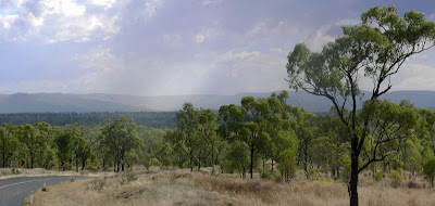
This is just a shot of weather that we were heading into. It had vanished before we reached those distant hills.
Alpha however, was one of those places that we warmed to almost immedia. One of our first encounters was with the town baker. A real character who quizzed us on our origins and finally wondered if we had a recipe for Melton Mowbray pies.
It publicises itself as the town of murals and we drove/walked the town trail to find them all. Here is just a sample.


Tuesday, 1 September 2009

Cania Gorge to Dingo

From Cania Gorge to Dingo is 270 kms. (169 miles).
Many towns and villages in Australia have imposing murals and this community centre in Lewty is typical.
It is a rural route virtually all the way and we were struck by the change of crops having lived surrounded by sugar cane for some while now, it was interesting to see wheat (or is it barley) ripening in the sunshine.

Pausing through Biloela for fuel, we also were compelled to buy new sleeping bags. The last nights spent in Cania Gorge were cool and our 'vintage' bags showed their age.

Dingo we felt was an optimum target for a stop-over and on reaching the town we were quite surprised how small it was. After cruising the area twice, we found the site and asked for a place to pitch our tent. "With power please." We always ask, it helps to use the computers to download and look at our photos of the day. "You could have an air conditioned room for the same price," was the reply. So we opted for an air conditioned room. 'Bijou' I think would be the standard estate agents' description.

The town boasted a statue of...

...a dingo.
And also a fair sized Rodeo ground. We loved the advertisements around the arena and also the old railway station offices that were now used as Rodeo Officials' offices.

Monday, 31 August 2009

Cania Gorge

Breaking ourselves in gently, it is just 120 kms to Cania Gorge.
Most of the trip is over familiar ground, but the roads are good and the scenery is very pleasant north and west of Bundaberg. We pass through Gin Gin, site of Queensland's oldest Station and onwards to Monto. A suitable spot for a lunch break as it has a public rest stop with free electric barbecue. This feature is common to many towns and we find it very useful as our current custom is to make pan bread (locally called Damper) to eat with some filling or other.
Like so many towns in this area, Monto's history goes back to the 1840's when the land was deemed pastoral, Then in the 1970's there was a gold discovery, but this was short lived and the town reverted to pastoral farming and also logging.
Just 20 kms further on an we arrive at Cania Gorge camping park. A very pleasant setting, in the gorge with a backdrop of sandstone escarpment. It is late afternoon, so we identify the walks that are recommended and pick a couple of options for tomorrow.

The site is mainly for campers and caravans and we 'tenters' are allocated the most scenic of the sites areas, down by the creek - which is very low at the moment.

In the morning, we make an early start and tackle three walks; first a very short hop to spot a rock with unusual stains or shadows in its face. They look very like a giant footprint and give the title 'Bigfoot' to the track.
Next is a longer trek, of perhaps 6 kms to the 'two-tier bat caves'. Much of the track follows the line of the road before rising up a small escarpment. We found the caves, the second tier is accessed by means of a short scramble through the first. Even having made the effort we failed to spot any bats, but the cave itself was worth the visit.
Finally, the same track continues in a loop past some fern groves and a waterfall before reaching a high panoramic viewing spot.
The good news was that there was a lot of fine cloud cover which made it comfortable for hiking - however the bad news was that photos of the panoramic view were rather wishy-washy. Not a bad trade-off.

Wednesday, 26 August 2009

Camping on our own Doorstep.

It's quantum leap time. We will get around to filling in the dates leading up to this date, especially as they contain some of our most enjoyable times in Oz, with Brian and Audrey Adams.

But it's all happening so quickly, we're now on tour, in a tent; Ellida is on the hard at Bundaberg to sit out the cyclone season whilst we embark on what we hope will be our 6 month, 15,000 kms trip to see all except the southeast of Australia ...which we did with Brian and Audrey ...which I will fill in later ...which brings me back to where I started.
We left the Marina and booked in a Burnett Heads Caravan Park, just 800 metres away as the Ibis flies. Very sensibly we thought that we could try out tent living whilst we still able to go back and grab the forgotten item. And we did, several times.
In a way it was a baptism of fire. Burnett Heads was enjoying a four or five day spell of high wind and it was blowing hard as we erected our little dome tent for the first time. It went pretty smoothly really all things considered and the tent withstood the blow very well.

The nights were puctuated by a rhythmic 'hooting', more a sort of 'poooom, pooom' sound that went on for several minutes at a time, ending with a crescendo of pooms before stopping for a break.

The next day I traced the origin, the mysterious 'poom' bird. Extraordinarily hard to spot, it was a Tawny Frog Mouth. Not extrememly rare, but rarely seen ...for obvious reasons.
Our first target destination is the National Park at Cania Gorge.

Friday, 30 January 2009

Toowoomba to Warwick

Leaving Toowoomba, we had a wonderful drive south. Warwick was our next target destination, less than 60 miles away, but with so many townships and tiny villages en route we knew it was folly setting our sights too far ahead.
In fact just outside Toowoomba is the Bull's Head Tavern, possibly the oldest building in Queensland.
It was on this route that we had our first taste of the sheer vastness of the landscape in Australia. We all know it's a big place, but it is reflected in the immediate landscape, there are fewer boundaries marked, less buildings etc.
We popped into a small village named Nobby. Having read about two of her illustrious offspring; Arthur Hoey Davis, a turn of the century Australian authur who adopted the pseudonym Steele Rudd, after whom the Rudd pub is named and Sister Elizabeth Kenny who was a phenomenon in the field of nursing. Try following this link to see what I mean.
Nobby may be a tiny village, but it did rate a School of Arts!
And some delightful farm dwellings on the outskirts.
After just a short drive south we paused at Allora - because it looked charming. The massive hotel - so many Australian towns have similar gigantic hotels, we can only assume that it speaks of the travelling style of yesteryear, when towns were days apart and folks just had to stop somewhere each night.
We were attracted by this bank as well.
Oh! ...and this charming little church.
Approaching Warwick, we couldn't avoid references to Jackie Howe. You have to appreciate that Liz had an uncle of that name hence the significance to us. He was a champion sheep shearer in the days prior to mechanisation. Such men were local heros and Jackie boasts a commemorative sculpture...
...and a Motel named in his honour. In 1892 he sheared 321 sheep in 7 hours and 40 minutes using hand shears. The record stood unbeaten until 1950 by which time powered shears were in use. Talking to modern sheep shearers, they reckon that 200 sheep per 8 hour day is expected of a good shearer. So Jackie was quite a champion. On the day he broke the record he was wearing a navy blue sleeveless vest that became the shearers' badge of office and was called a 'Jackie Howe'.
Warwick the town [pop: 12,562], lies on the banks of the Condamine River, 130 kilometres south-west of Brisbane and is the administrative centre of the Southern Downs Local Government Area. The surrounding Darling Downs have a strong agricultural industry for which Warwick, together with the larger city of Toowoomba, serve as convenient service centres.
A bit of history:

[Patrick Leslie and his two brothers originally settled in the area as squatters, naming their run Canning Downs. In 1847 the NSW government asked Patrick Leslie to select a site on his station for a township, which was to be called 'Cannington,' although the name 'Warwick' was eventually settled on. Land sales were held in 1850, and the first allotment was bought by Patrick Leslie. The telegraph to Brisbane was operating by 1861. The 1870s were boom years for this new town. In 1871 the railway reached Warwick, a brewery was built in 1873, then a cooperative flour mill and brickworks were completed during 1874.
We had a browse around the town. There are lots of grand buildings dotted around and several that just have a charm of their own.]

The Warwick Green Belt, on the banks of the Condamine river features a Sculpture of Tiddalik the mythical frog that drank all of the fresh water in a renowned Aboriginal Dreamtime story.
Just one more building that we found attractive. They are the Law Courts.