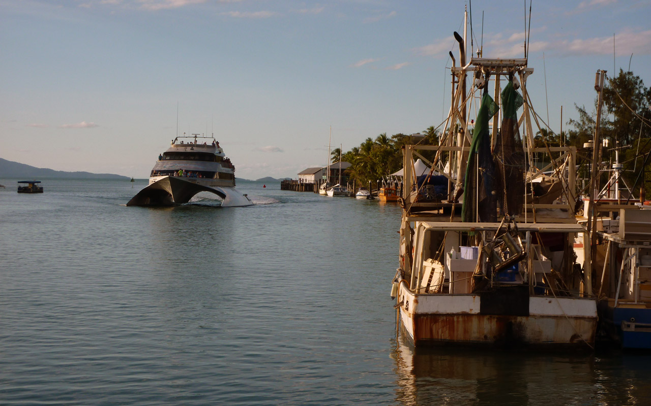
We timed out departure carefully and headed off to Port Douglas, entering Packers Creek at exactly high water ...and it was a doddle. We had a gentle motor into the Marina Mirage and berthed in shallow water overlooking the roadway into town.
The date is Friday 10th June and guess what... Monday is a bank holiday, so we greatly fear that this is not a rush job. I ring Dan and he seems quite unphased and seems to take no cognisance of weekdays/holidays/weekends, they're all just names. He'll be there tomorrow and start work. We were surprised and delighted, but still there is the availability of parts to consider.
Dan came, measured up and announced that he has all the wire and fittings in his workshop. "Let's go and do it" he said. I followed him round the impeccable modern resort marina complex to the disused wharf with archaic sheds housing artisan workshops and scrap yards. Here was his workshop, open sided, no windows, but well stocked. He quickly found new wire of the correct size and thickness with fittings to match and with my help he swaged on the necessary terminals all within the space of an hour and we were back on board Ellida.
In fact he replaced two wires, the matching portside partner to the broken one as good practice dictates. Then we agreed that the rig required a full inspection,top as well as deck level, so he agreed to come on Bank Holiday Monday and carry out the survey.
After getting our repairs done so speedily, we had a couple of days to explore Port Douglas before the weather and tides would allow us to leave. The town proved to be fun and attractive. Granted it does have a lot of modern improvement, but it also has some interesting history too. The town is situated adjacent to two World Heritage areas, the Great Barrier Reef and the Daintree Rainforest. So tourism was bound to be a major industry. Like so many Australian towns, gold was the factor that led to its founding. In 1877 the discovery was made, the town (which has had several names) flourished and at its peak had a population of 12,000. Of course that dwindled and after a calamitous cyclone in 1911 struck the town and flattened all but 2 of its buildings. Post WW2 it was just a fishing village with a population of 100. but in the mid-1980s, tourism boomed in the region after investor Christopher Skase financed the construction of the world-class Sheraton Mirage. The rest - as they say - is history!
A small photo collection of Port Douglas:


All work complete and with confidence in our rig, we depart Port Douglas with an epic 8 mile journey ahead of us, all the way to the Low Isles. We could have made more miles if the tide times had bee suitable, but the Low Isles are renowned as a local beauty spot and so were too good to miss. Another point of note is their proximity to Batt Reef which gained notoriety as the place where Steve Irwin was fatally injured by a Stingray spine.

We were able to pick up a mooring buoy on arrival and we enjoyed a truly picturesque scene complete with neatly painted lighthouse. As we went forward to slip our lines the following morning, a turtle was grazing on the grass/algae on the mooring buoy - always fun to see.

We by passed Cooktown as we had already visited here on our land trip and the annual festival celebrating Cooks landing and stay here to repair the Endeavour after running her onto a reef. We also by passed the Endeavour Reef thanks to modern technology much of which is still based on those early explorers surveys.
It's over 100 miles to our next destination, Lizard Island. Famous in lots of ways. Athough it has an aboriginal history Captain Cook named the place Lizard Island in 1770; "The only land Animals we saw here were Lizards, and these seem'd to be pretty plenty, which occasioned my naming the Island Lizard Island." He also climbed the peak on Lizard Island to chart a course out to sea through the maze of reefs which confronted him and the island's summit has since been called ‘Cook's Look’.

Another part of it's history involves the heroic/tragic story of Mary Watson and her vain attempt to escape from attacking aboriginals to the mainland in a fish boiling tub. She was unsuccessful, ending her days on Howick Island, just 20 miles away.
Howick Island was in fact our next anchorage. Situated in a narrow deep water passage, it was an unusual looking anchorage on the chart, but as it was recommended we gave it a go. As it turned out it was calm and peaceful and we had a good night's rest there. Interrupted just once by a vessel that was too deep for the main channel and was committed to using the Howick Passage. We heard his radio annoncements and went up on deck to watch as he passed close by. (well it seemed close at night).

An early start for a 38 mile sail to Bathurst Bay near the Flinders Group of islands. Another of the 'gentle slope' variety. Approaching the bay on our chart-planned course, we could see another sailing boat near to shore, but it looked small enough to be just a dinghy. However as we inched forward in the very shallow depths for several miles the yacht seemed to get bigger and bigger - it was just an illusion caused by the distance we were offshore. We stayed further offshore than the other yacht and had our night's sleep.

One of the problems caused by our enforced stoppages in Gladstone and Port Douglas is our need to keep up the momentum. Today we were tempted to sail just a few miles an visit the islands of the Flinders group, but good sense prevailed and we put the miles in. The last few being very cautious as were were in very shallow partially charted water approaching Hedge Reef. Beth and Bone had been there before us and gratefully we had details of their precise anchoring position. It felt unusual to be anchored in the open sea - we knew there was a reef protecting us - but we couldn't see it!

Thirty miles is just right for a day run. Roughly 6 hours sailing for us. As we approach Morris Island we can see that it is several miles long and has vegetation and a light. Looked ideal as a sheltered anchoring spot. As in fact it was, we spent a pleasant night there with a lovely island view.

We had a choice at this point; Lloyd Bay was the next significant stopping place, but at 51 miles it was a long hop. We could stop at Night Island, which looked pleasant enough with shelter given against the prevailing southeasterlies, but the long term forecast was promising high winds we thought we had better make the push for Lloyd Bay and be prepared to sit out the bad weather.
We arrived in the late afternoon at Lloyd Bay which offered little shelter owing to the distance we were forced (by depth) to keep offshore. However we seemed secure and surprise surprise, there was a 3G broadband signal available from the vicinity of the Aborigine settlement at Lockhart River. And the bad weather came! Strong winds and rain to the extent that our anchor dragged at one point which left us hauling up and re-anchoring in rather nasty conditions. It seemed to go on for ever, but in fact is was just one week, nevertheless we were ready to move on. The photo shows Lloyd Bay in one of its more benign moods.

Portland Roads - literally just around the corner, 10 or so miles. Another open anchorage, it used to have re-fuelling facilities from a barge, but no more. A few boats share the space, some fishing boats and one or two yachts.

The wind is still strong, but after resting overnight we decide to make tracks north, to Margaret Bay. 43 miles of pretty reasonable sailing, that is until we reached Clerke Island and Nob Island. They mark the turnng point into Margaret Bay and we found that we had to make a track harder and harder into the wind. As if by magic the wind sensed our presence and stiffened to a robust 30 knots. Not far to go however and soon we were anchored in the lee of the land and the protection of the bay. We looked around and recognised several of the nearby anchored yachts, but it was getting late and it was blustery, so we did not make any house calls.
As darkness approached, one by one our fellow yachties made sail and disappeared into the dusk. We assumed that they had arrived the day before and we knew that it was an overnighter to make the Albany Pass and round to Cape York Bay, so it was to be expected.
Very soon after, we heard the sound of an approaching engine and spotted a large fishing boat that was bearing down on our stern. We waited and he kept coming closer until at last he was only a couple of metres from our stern. "We've got some shrimps if you've got some booze." Shouted a voice from the massively high bow towering above us. "We have a little beer and some spirits." I shouted back. The deal seemed to have been struck, we rustled up a six pack and a small flask of spirit and taking careful aim hurled them up to waiting arms. In return there came down a sack of mixed crustaceans. Exchanging thanks, the fishing boat turned off to anchor in deeper water and we examined our 'deal'.

Wow! There were (approximately) 6 large crayfish - more like lobsters really, more than a dozen Morton Bay Bugs and a couple of kilos of large prawns (known locally as shrimps). Our problem was how to keep such a haul. In truth we simply couldn't and sadly all the other yachts had left. So, as many of the creatures were still alive and kicking, we set them free. We kept a few crayfish, all the Bugs went overboard and we set about cooking the shrimps then and there. We had one full fridge!
Heading north once more we had an overnight journey to do which required careful timing. The Albany Pass has to be taken at the right state of tide i.e. at low water. The flood should then be north flowing which makes for a swift passage. All went well and we were round the top of Australia's east coast and into Cape York Bay feeling like one major hurdle had been surmounted. It's a famous challenge for land travellers too, there being no 'proper' road to here from Cooktown - several hundred miles of hard going. Several hardy souls had made the trip on the day that we came ashore and we watched the celebratory photos being taken.

We met Wendy and Ken from Cop-Out who were also anchored in the Bay and they offered us a lift in their dinghy. We simply had to go ashore here, 'the famous top right of Australia' it's only 80 miles from here to Papua New Guinea! But of course we are not going that way.

We had a fun walk along the beaches. Quite a few tourists were evident as people fly and boat in from Thursday Island, plus an adventurous few have driven up the dirt road from Cooktown - a long and arduous journey in a 4WD. The tip of the continent is clearly marked with a sign and we had to wait for the endless chain of tourists with cameras to have their fill ...before doing the same!
